Cities are not always what we see on postcards: there is a hidden side to each one of them and our main goal was to unmask and expose their secrets. We started by selecting cities that show something peculiar, different in their own way from the others, in order to collect data from different contexts around Italy. It was important to have cities with different landscapes, such as mountain and coastal cities, as well as different densities, such as metropolitan and suburban.
After choosing the cities, 10 in total, we started by creating key maps for each one of them, in order to indicate the routes to be followed while visiting them. We studied the cities from all kind of sources we were able to use: internet, tourist maps, Google street views, our previous trips…
The routes were decided with the logic of covering as much streets as possible within the time span we had. For the very first trips, we created walking paths with the aim of following them striclty . But when we actually arrivedin the cities , we needed to adapt to the different situations that we encountered. Sometimes, we had to change the routes because of a technical problem and sometimes because the maps were not matching with reality. In some cases, we just felt the need to wander through the streets, which were waiting to reveal their secrets. We soon realized that it was very important not to have a fixed agenda in mind while mapping these cities and to record everything along our path.
Broadly mapping each city helped us avoid limited results. By rejecting any mapping constraints, we managed to obtain objective computer generated results, which made our study even more accurate at the end.
Tipically, what is visible in a city is perceived as shiny and well-maintained; contrary to what is hidden, which is dark, unsafe, and neglected. Therefore, we tried to work on paths that highlight the contrast between historic centers and suburban areas, showing all the shades that the city has created for itself. We encountered this distinction not only at an urban scale but also at an architectural one . A clear example is the Santa Maria del Fiore cathedral in Florence, in which the front facade displays a clean white and green color, while its back has darker grey tones.
For each of us, this journey has been a real exploration that revealed aspects of the cities that we did not notice before. During this learning process, we had to deal with several unexpected situations; nevertheless, the final result and data collected were remarkable.


Team: Begum Sardan, Esra Kagitci, Gokhan Dede, Ilaria Donadel, Manuel Zangirolami, Martina Ghidini, Michelle Rodriguez, Paoloandrea Paganotto.
Contributors: Guijia Zhao, Guilia Annese, Giulia Grassi, Guitsa Herro, Huihong Zhai, Luca Spolaore, Olga Beatrice Carcassi, Sebastiano Nespoli, Shangyu Lou, Yinglei Li.
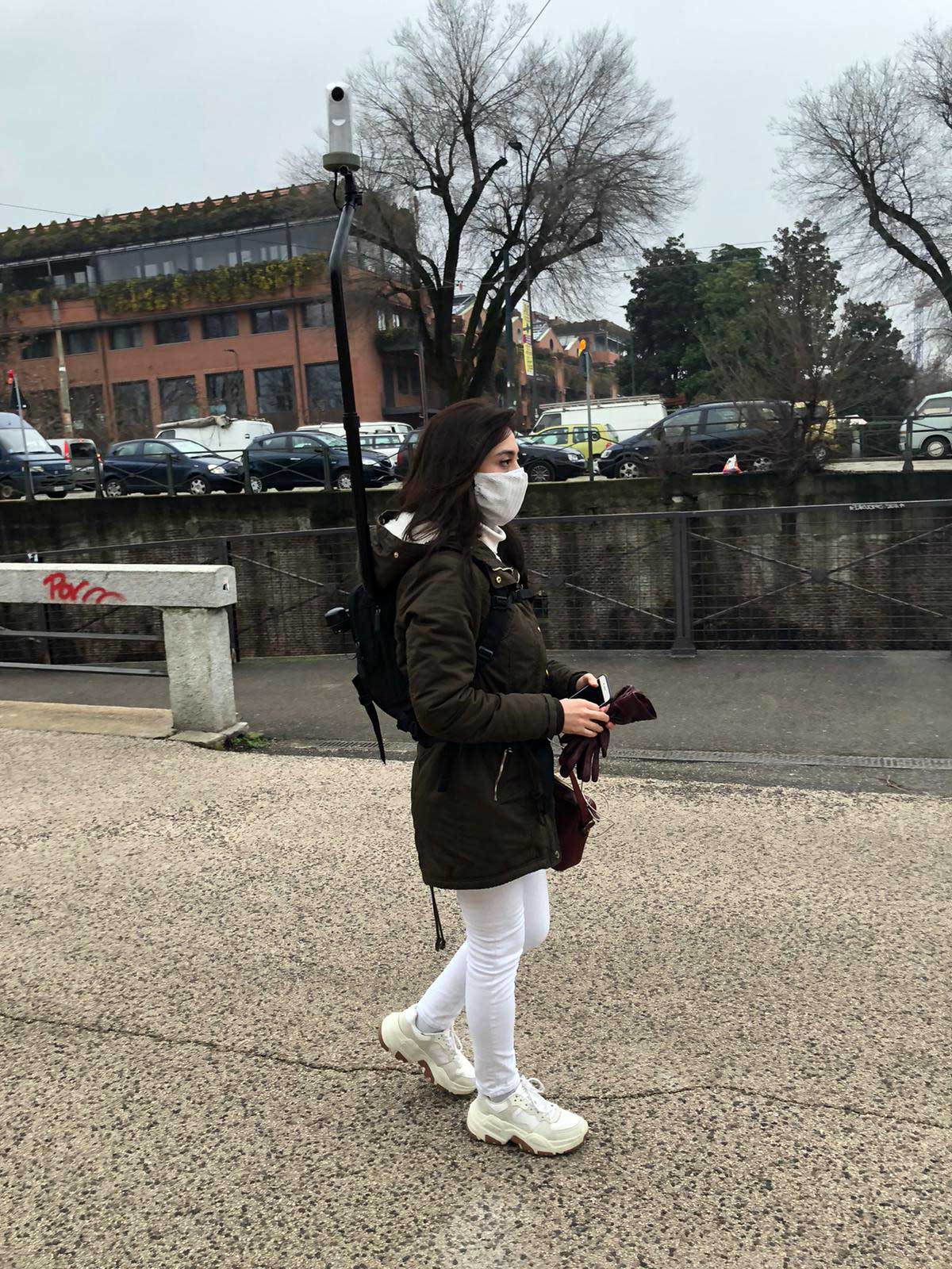
Milan, being the host city of the Politecnico di Milano, was considered the first experimental city for data collection, where we had the opportunity to first try the specialized equipment for capturing street views.
We planned to work with three groups. Each group was composed of two people and was assigned a device that could easily fit in a backpack and a path to follow. Milan is best known for being a multicultural city, which demands its inhabitants to lead a hectic life, often limited to the concentric ring road that defines the center. That is the reason why we decided to cross that border and capture with the camera the diverses realities and morphologies that the city has to offer. As soon as we started to walk, we noticed how the skyline began to change, showing the remains of an industrial city that has grown in height surrounded by a complex railway network that little by little is becoming the heart of the city. The further we got from our starting point, the more difficulties began to appear. Since it was not clear yet how to handle the equipment, what should have been a 2/3-hour walk in a city that we know well ended up being an exhausting walk of 6 hours. All the while, we had internet connection problems and we feared that the speed of our walk and the constant movement of the camera support could result in out-of-focus or blurry photographs.
Apparently, working with this type of equipment was something new not only for us but also for pedestrians, who were curious about what we were doing and the technology that we carried on our back.
In Bergamo, we continued to learn how to use the equipment, trying to learn how to efficiently carry a camera on our shoulders, always checking via a mobile phone that the camera view was straight enough to avoid rotated view pictures.
The most challenging part of this trip was not related to technology, but to the weather. The day chosen for the trip was a cold winter day with some snowdrops, so that we had to be very careful with the equipment.. In addition, as our backpacks were always connected to our phones’ WiFi, we had problems with the batteries.-. Moreover, we had to climb all the way up to the ‘Città Alta’ (Upper Town). What seems a 1-hour walk on the map, turned out to be doubled because of inclination.
We noticed that suburban residential areas of Bergamo do not have a particular distinction: the environment can easily recall any other typical residential suburban Milanese neighborhood. The exception for Bergamo is indeed the ‘Città Alta’ , with its historically characteristic architecture, which reveals a magnificent Medieval city with neat brick facades and stairs.
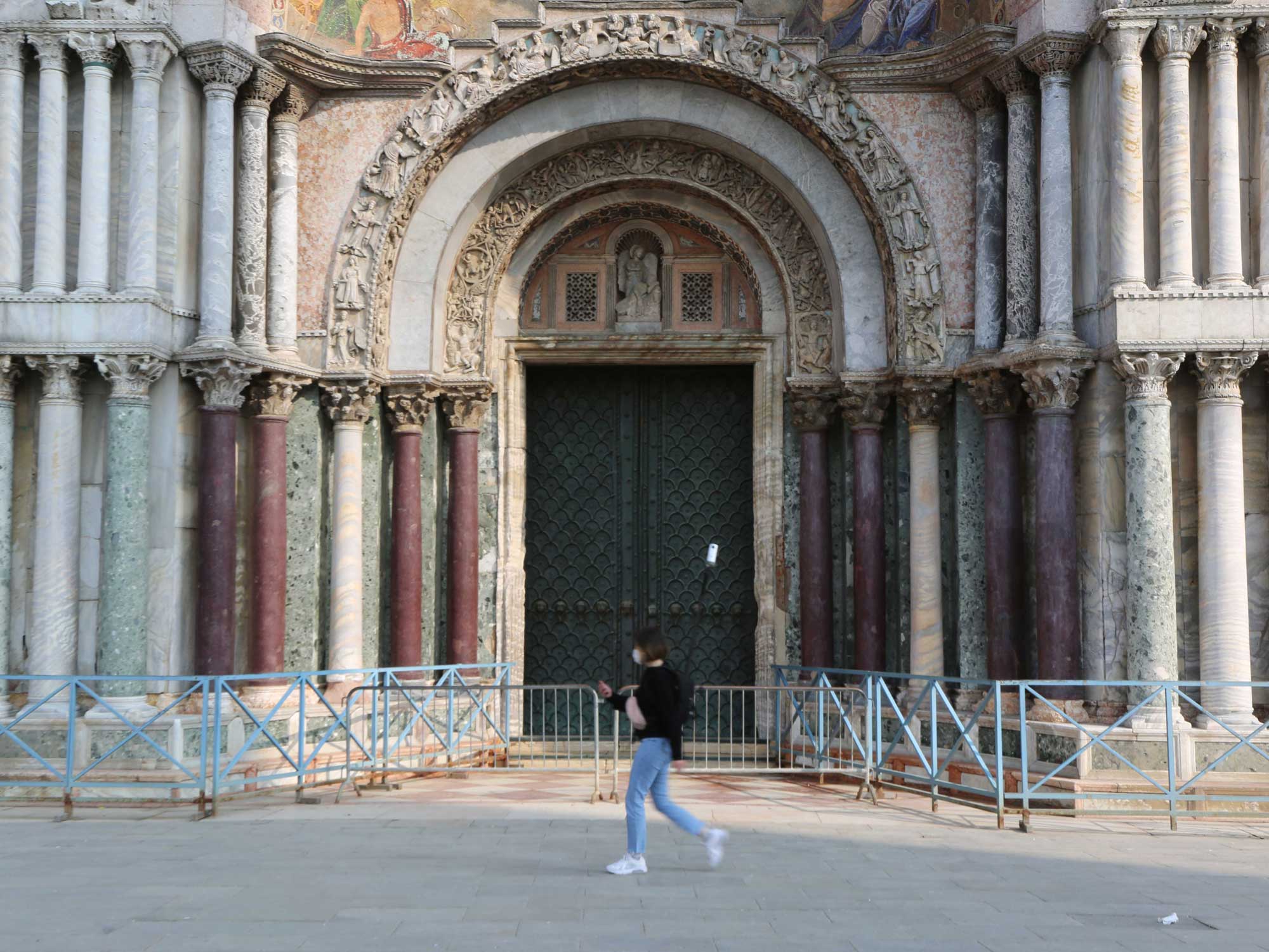
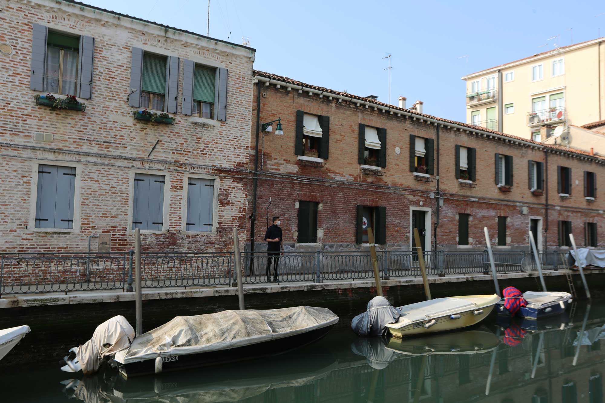
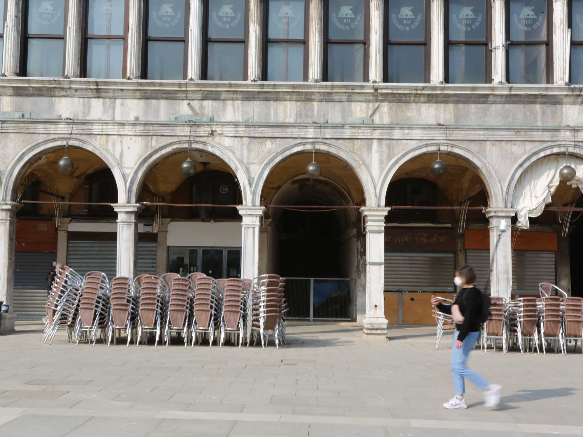
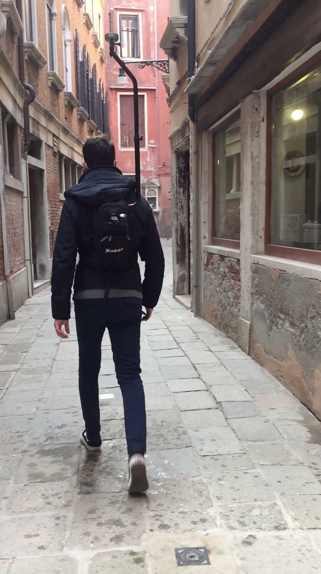
Venice was our first big and ‘real trip’. It was the most special one, since Venice is the host city of the Biennale and the one in which we could cover every single edge, alley, street, dead-end canal, and bridge. Each team spread through various areas and started to survey neighborhoods like Cannaregio, Dorsoduro, San Marco, Giudecca, etc. We discovered what a labyrinth the city is and how endless finishing its surveying could be. We first attempted to use online maps, but it was pretty challenging since what we were seeing on the screen was not exactly appearing physically there or, in other cases, the path showed was not accessible on foot.
By this time we had a more clear understanding of how to use the equipment, but here the methodology that we had been using in the previous cities had to change, since the aim was to survey the whole Venice. WiFi connection problems were more constant and lasted longer, which delayed the work. Additionally, due to the daily manipulation of the equipment, some of the supporting pieces broke and had to be replaced.
On the last day of the trip, it seemed to us that we could not finish our work, but the remaining paths were covered at the end of the day. Six people, a six-day trip, and a 150km walk per day showed us the manifold faces of the city. The authentic Venice was there without the mask of external visitors: finally, local life was visible and the city was able to breathe in peace.
In the end, we were able to discover the good and the bad, the clean and the dirty, the beauty and the ugly, and what is worth remembering or forgetting. Some things stayed with us : countless canals, lots of bridges and steps, long narrow streets, exposed bricks on buildings, mossy facades, children playing on the streets, clothes hanging out the windows, the ferry travelling through the castle, the cemetery, the grand canal, the neighboring islands.
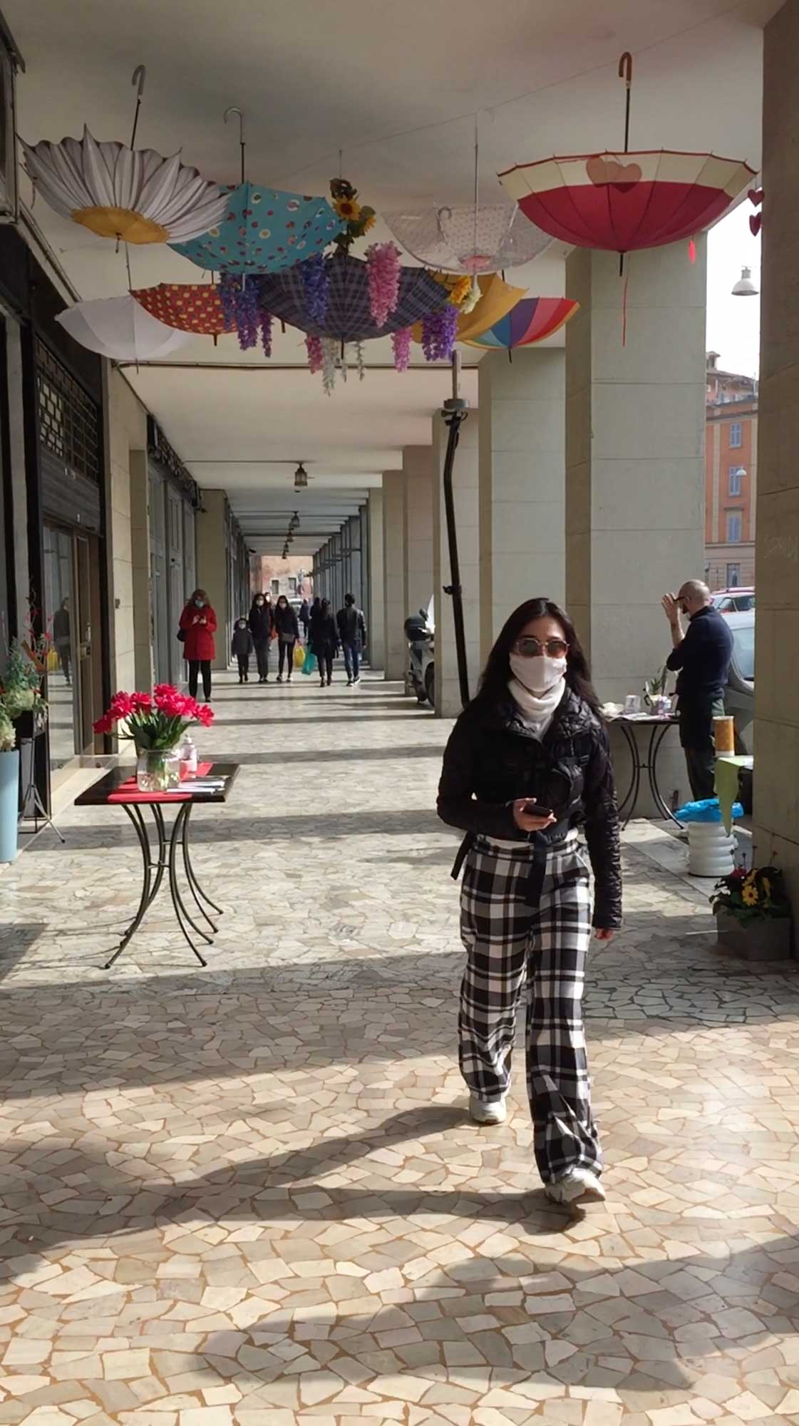
From Milan you can easly reach a lot of italian cities in just 1/2 hours of train: Bologna is one of them. It was a sunny weekend when we surveyed the city, and we had the chance to walk a lot between the typical Bolognese porticos . We started as soon as we arrived in the city. Walking from street to street it was amazing focusing on the colors and on the texture of the pavements of the city: a lot of diffent allignment, dispositions, distributions, pink stones, red bricks, pale yellow plaster, greysh sanpietrini.
The more we walked, the more we could appreciate the secrets that the city was hiding at just a first glance. There is a small canal that crosses the city right in the middle and, from a specif neighbourhood called “piccola Venezia”, you can see it flowing below the houses’ windows and being crossed with covered bridges. From a small window in the common portico you can see how the buildings softly touch the riverside stone. A man with his bike was opening a door, hidden under a red portico and we could peek a fantastic inner courtyard, were the lemon trees reached the second floor of the house. There, his wife was shaking her hand from a long glass corridor. Right in the city center, squeezed between two palaces, an iron rail offsetting from the building facade creates a semicircular entry hall. It was an old liberty theatre transformed into a commercial shop. Arrived in the Piazza del Duomo, the beauty of the cathedral of San Petronio is hidden by the front Portici di Bologna, a rectangular building standing right in the middle of the piazza. You can walk around it as a gigantic statue.
Under the sun of those days, the treasure of Bologna was shining in front of our eyes.
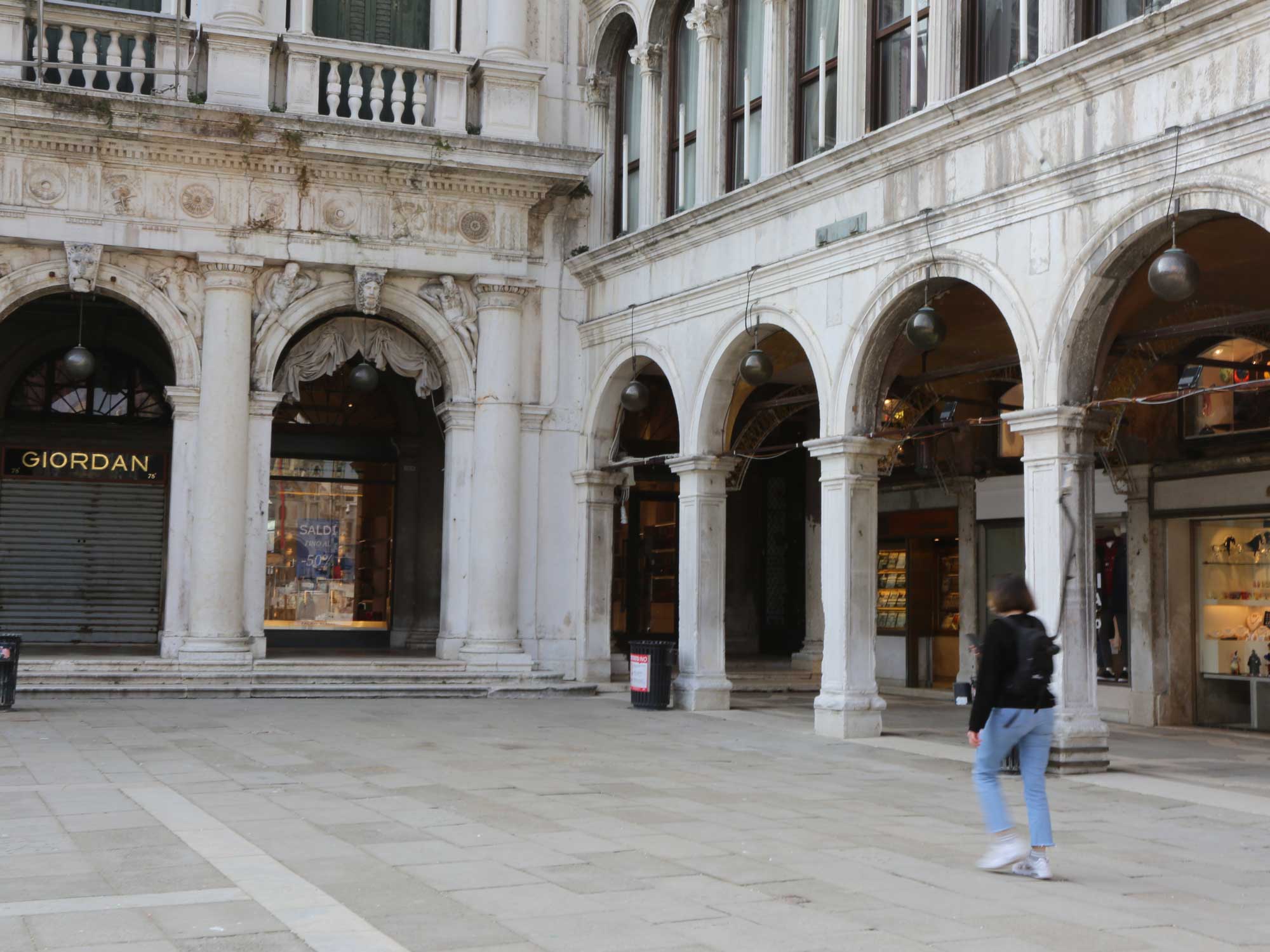
Two teams of two people, two cameras for two days: these were the basis of our survey in the Florence. The strategy adopted here had been preliminarly studied on maps by trying to set up itinieraries able to catch in pictures as many elements as possible in a very dense architectural and historical hub.
Once there, the city showed us its double nature, emphasized by the pandemic situation. Very few people around the places, no crowded lines in front of the Duomo, the exceptional emptiness of the Uffizi Square, for example, showed us how the city center and the Oltrarno area live separately: one striclty related to tourists and visitors (completely disappeared from our views), the other populated by residents and families. As in a learning-by-doing process, the same routes already defined were adapted step by step, in order to capture in all the framesboth these aspects.
Without any particular issues related to weather and climate, the only problem each group had was initially deriving from the equipment. Wifi was fine, devices and cameras were fully charged but Geotags, showing the exact locations of photos, were not presenting any progression in the survey, which significantly slowed down the first day of recordings. Because of that, we learned an important lesson we were so far understimating: equipment needed to rest too, so to have enough time to re-elaborate the data it was capturing. All the data in the equipment were saved into a hard drive and its memory was deleted to be used again.
The following and last day, the modified strategy and the new awareness acquired let us survey witout any issues, allowing both teams to complete and even implement their own paths.
“Quel ramo del lago di Como, che volge a mezzogiorno…”: this is the beginning of the Promessi Sposi. Well, we went to the other branch, the one that gives its name to the lake, Como. Our mapping journey continued in this small town of Roman origins, just a stone's throw from the Swiss border. Just by looking at the map, you can see the incredible morphology of this city: a small historic center that juts out towards the shores of the lake, embraced by major roads. It has a horseshoe-shaped development, which extends from the east bank to the west bank, passing through the central square of the city and its small port. It really looks like a small jewel, whose brilliance is amplified by the reflection of the lake’s water.
We were two teams with one camera each: that was sufficient given the small size of the city. Compared to other inspections, there were not too many technical problems and this allowed us to forget for a moment the equipment and the project and pretend we were doing a nice Sunday walk on the lakefront – were it not for all the other people who were too curious about the strange "alien" that we carried on our shoulders and decided to stop their run or brake their bikes to get some information!
At the end of the day, we could see the result of our survey, which confirmed the strange articulation of the city. We started from the east coast, skirting the shores of the lake. This path is very "urban", with small bars and restaurants that enjoy the view of the lake and that surely in happier times were animated all night long. We passed through the old town, via small streets and retail stores – the route in fact from linear became twisted – then back to the shore and along the entire west coast, which features beautiful pedestrian promenade that passes through large and beautiful historic villas-
To end on a high note, we went to pick up the car in a car parking, built right above the ruins of the ancient Roman city.
How best to describe our adventure in the city of Genoa? Perhaps the most appropriate adjective is also the one that describes the city itself: complicated. Genoa is complicated in the sense that it is always different, there are never two similar streets or two squares that respond to the same compositional rule. Moreover, it is a city built between the sea and the mountains, so how could it be otherwise?
Our trip was complicated because we left in three couples, but once we got there we discovered that one of the cameras was no longer working. We thought it was one of the usual problems encountered on other trips, so we tried everything to make it work but nothing changed. So, we found ourselves with only two cameras and we had to choose which of the three planned routes to take. The choice fell on a linear route that started from the station and ended in the Boccadasse district, an ancient fishing village. In this case, we were interested in understanding the morphology of these old villages, passing through the waterfront. The other route developed mainly in the city center, through the small ‘carrugi’, up to the causeway that surrounds the center on one side, and on the other side the port and the large aquarium.
What has not been mentioned yet, but perhaps was the most important aspect for our work, is the slope of the city. The routes established on paper were calculated to be about 15 km for a total of 4/5 hours, but after a few minutes from the start we realized that the time would be doubled: there is not a single flat street! But against any expectations, in a continuous up and down and a lot of breathlessness, we managed to catch the train back home concluding the mapping, and also with a good piece of focaccia in our hands!
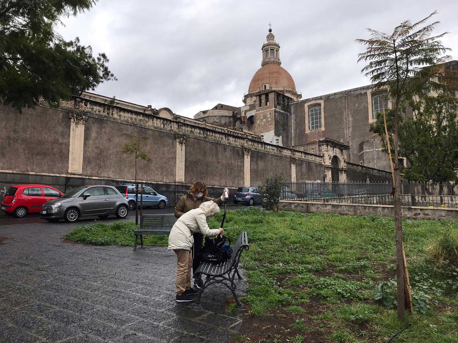
It was a dark March morning and we were directed toward the airport. Destination: Catania. Self declaration checked, check-in done, we took off, landed, and got into a taxi for the city center.
What we noticed from the beginning was the dark color of the pavement of the streets. The taxi driver explained us the reason: everything was made with the stone of the Etna volcano and since it is a type of lavic stone, it is characterized by a strong dark shade. It was amazing how the black powder stick to our shoes while walking. But more amazing was to look at the wet floor after the rain to find a mirror there: a sort of reflect effect.
After the check-in in the B&B, we immediately went out to try the first survey. We had two backpacks but we discovered that one was not properly working, so, we would do the survey with just one. Another difficulty was the bad weather condition. Sicily is known for the sun and the fantastic mediterranean climate. What a funny thing! We totally missed the chance to see the traditional Sicily. It rained every day and it was really cold. This reduced the surveying possibilities because we could not register under those rainfalls. Our surveying schedule was limited to the small frame of time when the rain stopped, and since it was not possible to predict the weather, we spent our days sitting next to the window constantly looking outside and trying to find out the right time to work. As soon as we saw a ray of sun we ran in the city’s streets to map.
Passing from alley to alley, the city was surprising: on one side, orange trees and decorative stones on buildings’ walls, on the other, a gigantic empty plaza and a parking lot; here, the windy seaside, there neglected markets, pastry and butcher’s shops.
Three days passed. Check-out, suitcases, bus, another experience. Direction: Palermo.
Sicily was one of the last regions to be surveyed, and Palermo was probably one of the most desired cities and the one of which we enjoyed the most. Not only because of its beautiful landscapes and the amazing street food, but because we did not have to face significant weather and technical problems. After Catania, we already knew what was the dynamic that worked better for the team and how to manage the schedules by having just one camera.
By then, winter was coming to an end and the spring sun allowed us to appreciate the character of the different the neighborhoods, that can be quite distinguishable: from the charm of the street markets surrounded by faded homes and remarkable monumental sites, to contemporary areas with massive squares.
While one group walked the streets in the morning, the other planned the route that would take place in the afternoon. Finally, we could plan. As was the custom in the coastal cities that we had visited, we could not miss the tour of the port to feel the seaside atmosphere. Here was the first time we were confronted by police officers, who asked us to delete the photographs for police security. Luckily, we did not lose the data in the end. What we keep from the experience is the characteristic architecture, the mosaics, the cobbled streets, the tropical vegetation, the warmth of the people.
For some of us, the journey ended with the survey of this city.
Rome, the last city to survey, has probably also been the most challenging one, for both weather and equipment aspects. Two backpacks out of three had been taken from the Lab to cover as much streets as possible in four days. Unfortunatelyone of the two cameras resulted unusable, showing a problem we never saw before and that we would not been able to be solve from there.
By using the only available equipment, the first and last day were the most productive since different surveys were done both in the morning and in the afternoon, covering respectively itineraries in the western and eastern part of Rome without particular issues, if not for a couple of hours of rain.
The most relevant issues happened during the second and third days, once again because of the weather: despite in the morning the situation allowed to start the surveys, we experienced an immediate deterioration of weather conditions, which forced us to interrupt our activities, without any possibility to resume because of incessant rain, or even, hail.
Summing up, the possibility to use just one camera for the whole trip and the instability of the weather made difficult the entire survey process, limiting the opportunity of walk only to a couple of hours per day and just for one of the groups without possibility to swap teams.
Nevertheless, we were able to capture an atypical image of the city by walking trough places that had never been pictured as empty as we found them: Piazza San Pietro, Piazza Navona, Trevi’s fountain, the Pantheon, the Colosseo with the Fori area, but also the streets in-between all of them and on both sides of Tevere River, contributed to frame a digital version of Rome now reduced to its essence, highlighting its complexity and progressive evolution in more than 2500 years of history.


